This is a post by Emily Markert. See her bio at the bottom of this post.
In the aftermath of Hurricane Irma, a team of analysts from the National-Geospatial Intelligence Agency (NGA) were tasked with manually annotating satellite images for signs of destruction, such as damaged buildings and roads, to facilitate the recovery and clean-up effort. The painstaking and time-consuming nature of this important task inspired the NGA to seek out a method of automating the annotation of satellite images, in hopes of improving the efficiency of damage reporting after future disasters.
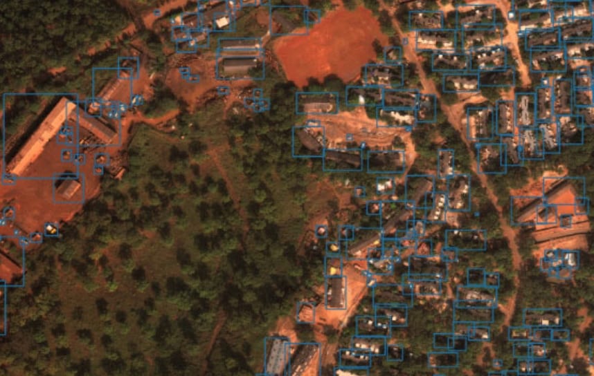
Image credit: DIUx xView Dataset
To address this problem, the Pentagon has launched the xView Detection Challenge, which offers a $100,000 prize for the algorithm that can most accurately detect items relevant to disaster relief, such as damaged buildings and vehicles, from a set of high-resolution satellite images. The challenge is being managed by DIUx, an organization that facilitates collaboration between the Department of Defense and technology companies, in partnership with the NGA. Submissions to the challenge were due by July 22, 2018, and the winning algorithms will be announced on August 3.
In an article published by Wired describing this challenge, Stanford professor Stefano Ermon, who is a member of this research network, notes the potential contributions of the competition to machine-learning research, as well as humanitarian work. Dr. Ermon’s own research involves using machine-learning to predict areas of poverty in Africa from satellite images. Under the assumption that well-developed and non-impoverished areas are brightly lit at night, Dr. Ermon’s team has trained an algorithm to pick out areas that are well-lit or dark, as shown in nighttime satellite imagery, and then identify differences between those areas in daytime satellite imagery. So far, identifying features such as roads and waterways have been used to successfully differentiate impoverished areas. Dr. Ermon and his team hope that their algorithm can provide an inexpensive and scalable method of supplementing household survey data in the identification, and eventually remediation, of poverty.
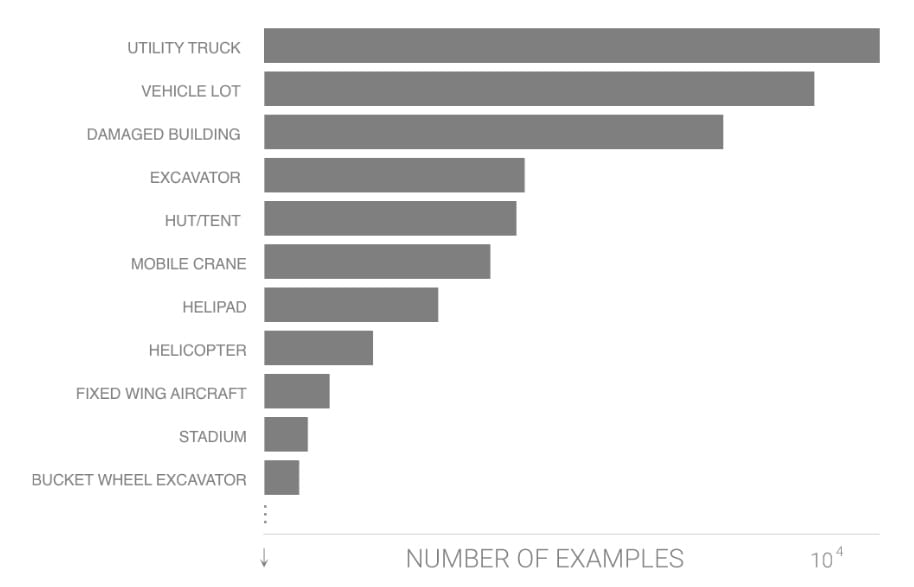
Image credit: DIUx xView Dataset
To learn more about Dr. Ermon’s work, visit his research team’s website, or watch a recording of his Computational Sustainability Virtual Seminar here.
Emily Markert is a Computer Science undergraduate at Vanderbilt University supported by NSF Grant 1521672. The opinions expressed herein are Emily’s and not necessarily those of Cornell University or NSF. You can reach Emily at emily.markert@vanderbilt.edu.